North Male Atoll Map
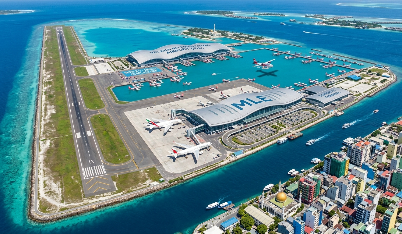
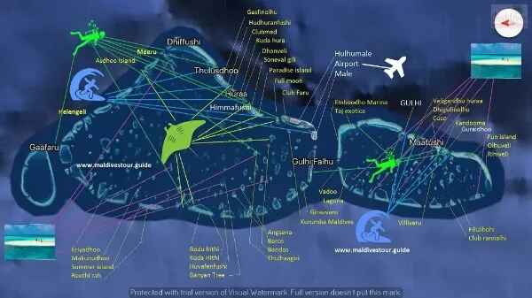
North Male Atoll is the most mapped, most planned, and most researched part of the Maldives - because it is where most first-time visitors land and where most decisions about which resort to book are made. The map above shows the full atoll, from Male city and Velana International Airport in the south to the outer islands in the north, with every resort island marked in position.
How to Read This Map
The airport sits on Hulhule Island, immediately adjacent to the capital Male on the southern edge of the atoll. Everything north of that point is resort territory private islands strung along the inner and outer reef system of the atoll, each one accessible by speedboat from the airport jetty.
The straight-line distance from the airport to a resort island does not reflect the actual travel time speedboats navigate the lagoon channels rather than the open ocean, so the routes are longer than they appear on the map. A resort that looks close to the airport may take 40 minutes by speedboat due to the route. A resort that looks further away may be faster if the channel is direct.
Transfer times are the most useful navigation tool for North Male Atoll more useful than distance, more useful than general position on the map.
Resort Positions - North to South
The outer reef edge of North Male Atoll runs roughly north to south along the western side of the atoll. The most distant resorts - One & Only Reethi Rah, Gili Lankanfushi, Coco Bodu Hithi sit in the northern and northwestern sections of the atoll. These are 40 to 60 minutes by speedboat or yacht from the airport.
The middle section of the atoll - where Baros Maldives, Four Seasons Kuda Huraa, and Huvafen Fushi are positioned is 25 to 40 minutes from the airport.
The resorts closest to the airport - Kurumba Maldives, Bandos Maldives, Hulhule Island Hotel sit in the southern section of the atoll within 10 to 20 minutes by speedboat.
Key Resorts by Speedboat Duration
| Duration | Resort Examples | Position | Channel Route Type |
|---|---|---|---|
| 10-20min | Kurumba, Bandos, Hulhule Hotel | South near airport | Direct south |
| 20-30min | Gili Lankanfushi, Baros | NW/West mid | Lagoon shortcut |
| 30-40min | Four Seasons Kuda Huraa, Huvafen Fushi, Coco Bodu Hithi | Mid-central | Western reef |
| 40-60min | One&Only Reethi Rah (yacht) | NW outer extreme | Outer navigation |
Key Islands on the Map
Male - the capital city on the southern edge of the atoll. Two square kilometres, 200,000 people, ten minutes by ferry from the airport island.
Hulhule - the airport island. Velana International Airport, the seaplane terminal, and the domestic terminal are all here.
Hulhumale - the reclaimed island connected to Hulhule by the Sinamale Bridge. Guesthouses, mid-range hotels, and the primary overnight option for guests with late arrivals before a seaplane the following morning.
Vihamanaafushi - Kurumba Maldives. The oldest resort in the Maldives, ten minutes from the airport.
Baros - Baros Maldives. 25 minutes from the airport. Best house reef in the atoll for direct-access snorkelling.
Gaaviyan - Gili Lankanfushi. 20 minutes from the airport. Overwater house villas, Mr Friday butler service.
Reethi Rah - One & Only Reethi Rah. One of the largest private resort islands in the Maldives. 55 minutes by luxury yacht.
Kuredu - Huvafen Fushi. 40 minutes. Underwater spa, small-scale luxury.
Fushivaru - Four Seasons Kuda Huraa. 25 minutes. Traditional village architecture, strong family programme.
Medhufushi - Coco Bodu Hithi. 40 minutes. Boutique, strong dive programme.
Local Islands Visible on the Map
Thulusdhoo - the surf island. The Cokes break is visible from the beach. Multiple guesthouses, local cafes, surf culture.
Himmafushi - quieter local island with traditional lacquerwork and the Jailbreak surf break.
Dhiffushi - longest natural beach in the atoll. Minimal tourist infrastructure.
Guraidhoo - southernmost local island in North Male Atoll, accessible by public ferry from Male.
Map Section Insights
| Map Section | Transfer Range | Example Islands/Resorts | Pro Tips |
|---|---|---|---|
| Northern | 40-60min | Reethi Rah, Gili, Coco | Yacht for luxury, reef edge |
| Mid | 25-40min | Baros (house reef king), Four Seasons | Family + dive balance |
| Southern | 10-20min | Kurumba (1972 pioneer) | Late arrivals, value |
| Local | Ferry access | Thulusdhoo (Cokes surf) | Public ferries from Male |
Using the Map for Transfer Planning
When comparing resorts in North Male Atoll, position on the map tells you the general direction northern outer reef, inner lagoon, southern section but the specific speedboat route determines the actual transfer time. Resorts on the outer western reef edge typically have longer routes than inner lagoon properties at the same map distance from the airport.
Every resort in North Male Atoll uses speedboat transfer. No seaplane is required for any property in this atoll. Transfers operate at any hour there are no daylight restrictions. A late-night international arrival at Velana International Airport can still reach any North Male Atoll resort the same evening.
Compare Live Rates & Exclusive Deals
Compare Live Rates & Exclusive Deals
Featured Hotels & Guides in this Collection (1)